Best of the
Best
Editors' picks and our top buying guides


Best of the
Best
Editors' picks and our top buying guides
Latest

How to Watch and Stream the 2024 Chinese GP
1 hour ago
World Snooker Championship 2024: How to Watch Live From Anywhere
6 hours ago
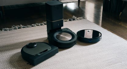
Best Filtered Water Bottles of 2024
7 hours ago
Best Cheap Mattress for 2024
8 hours ago
Energy's New Wave: Meet 4 Women Powering America's Clean Energy Transition
9 hours ago
US House Could Vote on TikTok Ban This Weekend: What to Know
9 hours ago
Cicadas Are Coming, and So Are the Cicada Salad Recipes
10 hours ago
Apple's Upcoming 12.9-Inch iPad Air Is Rumored to Have a Pro-Level Screen
10 hours ago
Boston Dynamics' New Humanoid Robot Is Freaking People Out
10 hours ago
This $480 Harman Kardon Speaker Is Down to Just $80 for a Limited Time Only
10 hours ago
NBA Playoffs 2024: How to Watch Play-in Tournament on Friday
10 hours ago
Tesla's Cybertruck Recall Is Just the Latest: What EV Drivers Should Know About All Recalls
10 hours ago
Apple Users in Europe Get a New Third-Party App Store
11 hours ago
Google Maps Will Use Artificial Intelligence to Help You Find EV Chargers Everywhere
11 hours ago
'Tortured Poets' Music Video Drops Tonight. What to Know About Taylor Swift's New Double Album
11 hours agoMore to Explore
Reviews, advice and more from CNET's experts.


Get the best price on everything CNET Shopping helps you get the best prices on your favorite products. Get promo codes and discounts with a single click.
Add to Chrome - it's free!
Our Expertise
Expertise Lindsey Turrentine is executive vice president for content and audience. She has helped shape digital media since digital media was born.
0357911176
02468104
024681024
Featured in
Tech


Upgrade your inbox
Get CNET Insider
From talking fridges to iPhones, our experts are here to help make the world a little less complicated.
Featured in
Money


Crossing the Broadband Divide
Millions of Americans lack access to high-speed internet. Here's how to fix that.


Featured in
Energy and Utilities


Deep Dives
Immerse yourself in our in-depth stories.


Get the best price on everything CNET Shopping helps you get the best prices on your favorite products. Get promo codes and discounts with a single click.
Add to Chrome - it's free!
Featured in
Internet


Sleep Through the Night
Get the best sleep of your life with our expert tips.


Get the best price on everything CNET Shopping helps you get the best prices on your favorite products. Get promo codes and discounts with a single click.
Add to Chrome - it's free!
Tech Tips
Get the most out of your phone with this expert advice.


Get the best price on everything CNET Shopping helps you get the best prices on your favorite products. Get promo codes and discounts with a single click.
Add to Chrome - it's free!

Featured in
Home


Living Off Grid
CNET's Eric Mack has lived off the grid for over three years. Here's what he learned.